


Update: Winter storm warning issued for Berks County; 10 to 15 inches of snow possible
Original post: Berks County is expected to see significant snowfall this weekend as a major winter storm moves through eastern Pennsylvania, according to a briefing issued Thursday afternoon by the National Weather Service in Mount Holly.
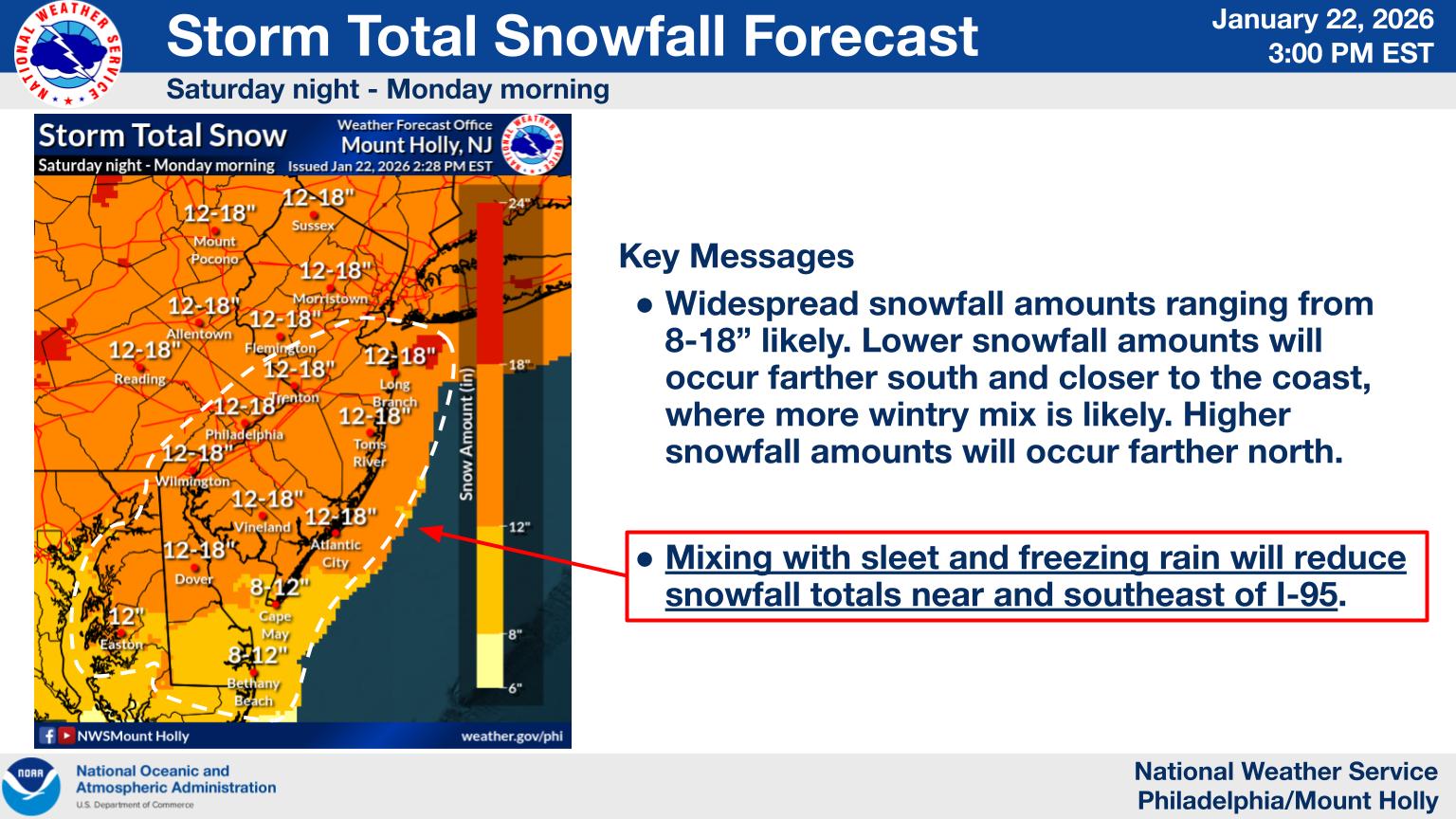
Forecasters say there is increasing confidence that the storm will bring 12 to 18 inches of snow to Berks County between Saturday night and early Monday morning, with heavy snow expected to create hazardous travel conditions and potential disruptions across the region.
A Winter Storm Watch remains in effect for Berks County from 7 p.m. Saturday through 1 p.m. Monday, with officials warning that snowfall rates could make roads difficult or impossible to travel at times. Widespread closures and impacts to infrastructure are possible if the higher snowfall totals materialize.
In addition to snow, the National Weather Service is also highlighting the risk of dangerously cold temperatures ahead of and following the storm. A Cold Weather Advisory is in effect from Friday night through Saturday morning, with wind chills expected to drop between -10 and 0 degrees, increasing the risk of frostbite and hypothermia for anyone outdoors for extended periods.
While areas farther south and closer to the I-95 corridor may see some mixing with sleet or freezing rain, forecasters say Berks County is more likely to remain cold enough for predominantly snow, allowing for higher accumulation totals. Blowing and drifting snow is also possible Sunday into Monday, which could further reduce visibility on roadways.
The cold is expected to linger well beyond the storm, with below-normal temperatures forecast to continue through much of next week. Officials note that snow and ice may be slow to melt, prolonging hazardous conditions on untreated surfaces.
The National Weather Service plans to issue an updated briefing by Friday morning as the storm approaches. Residents are encouraged to monitor forecasts closely and prepare for difficult travel and prolonged cold conditions.